My Safetipin


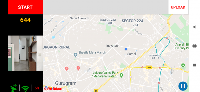
My Safetipin is a personal safety app that helps you make safer decisions about your mobility, based on the safety score of an area. The app is free for all and uses crowd-sourcing to collect data. At the core of the app, we have the Safety Audit which is a tool to analyse a given area based on the physical and social infrastructure parameters. A user can contribute to a better understanding of their city by doing a Safety Audit through the app.


There are 9 parameters and based on the ratings given to these parameters, a safety score is created. The parameters which are a part of the audit are:


Lighting – Availability of enough light to see all around you

Openness – Ability to see and move in all directions

Visibility – Vendors, shops, building entrances, windows and balconies from where you can be seen

People – Number of people around you

Security – Presence of police or security guards

Walk Path – Either a pavement or road with space to walk

Public Transport – Availability of public transport like metro, buses, autos, rickshaws

Gender Usage – Presence of women and children near you

Feeling – How safe do you feel


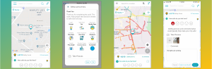
The My Safetipin app has many other features too.


SAFETIPIN NITE

Safetipin Nite is an app that is used to collect photographs in the night-time. This is done by mounting the phone with the app on it on the screen of a moving vehicle. The app is not available on the Play Store or the App Store. We provide the APK to our partners that can be used by the drivers who will be navigating the area. As the drivers drives around an area, the app automatically clicks photos every 30 metres. These photographs are then uploaded and analysed by our team based on the 8 audit parameters as well as various sub-parameters. The data collected by the Safetipin Nite app supplements the crowdsourced data that we get through the My Safetipin app and it provides and enhances the data coverage we have in a city.


SAFETIPIN SITE

It is a web application designed to collect information on selected public places or public services through a detailed questionnaire, pictures, and spatial data. For example, condition of public toilets, bus terminals, safety audits inside the buses, last mile connectivity around metro/train station or bus stop etc. This type of data gathering process helps in making effective decisions to address citizens’ concerns and experiences in using the public place.


To collect data at a specific public place using Safetipin Site, the first step is to build a set of questions to inspect or assess the place on a range of parameters. This can include objective as well as open ended questions that could help us in problem identification. The application’s questionnaire can be customized based on type of public place, geography, time etc.  Once the questionnaire is finalised, it is uploaded and hosted on Safetipin server. As these questionnaires require basic observational and analytical skills, surveyors are recruited and trained to feed data and images using the web application. Post-data collection, this geotagged information can be accessed as a shapefile or excel file by the project partners. This data can easily be integrated with existing city databases on GIS or multi-modal apps. In-depth analytical reports are also prepared to provide key recommendations and suggestions for improvement.


The Safetipin Site app can be customized for each project to collect additional information required by governments. This tool can be used both to diagnose safety issues and monitor public spaces, particularly those where interventions have taken place.


Download the My Safetipin app here:


Subscribe!

Join our mailing list for regular updates.